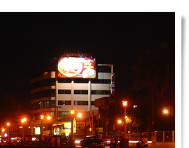
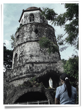
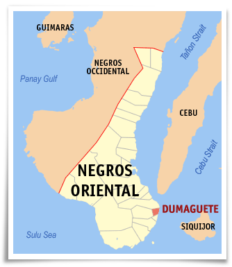
The City of Dumaguete is a city in the Philippine province of Negros Oriental. It is the capital, principal seaport, and largest city of Negros Oriental. According to the 2000 census, it has a population of 102,265 people. A person from Dumaguete is called a "Dumagueteño". The city is nicknamed The City of Gentle People.
Dumaguete is referred to as a university town because of the presence of seven universities and colleges, where students of the province converge to enroll for tertiary education. The city is also a popular educational destination for students of surrounding provinces and cities in Visayas and Mindanao. The city is best known for Silliman University, the country's first Protestant school. There are also 12 elementary schools and 9 high schools. The city's student population is estimated at 30,000.
The city attracts a considerable number of foreign tourists, particularly Europeans, because of easy ferry access from Cebu City, the availability of beach resorts and dive sites, and the attraction of dolphin and whale watching in nearby Bais Bay.
History
 "Dumaguete" was coined from the Visayan word "daggit" which means "to snatch". Because of the frequent marauding attacks of the Muslim pirates on the coastal town, and the power to attract and keep her visitors for good, hence, the word "dumaguet", meaning "to swoop," was christened to the village of Dumaguete. However, Diego Lopez Povedano in 1572, indicated the place as "Dananguet." But in 1734, Murillo Velarde referred to it, using its present name, as Dumaguete. "Dumaguete" was coined from the Visayan word "daggit" which means "to snatch". Because of the frequent marauding attacks of the Muslim pirates on the coastal town, and the power to attract and keep her visitors for good, hence, the word "dumaguet", meaning "to swoop," was christened to the village of Dumaguete. However, Diego Lopez Povedano in 1572, indicated the place as "Dananguet." But in 1734, Murillo Velarde referred to it, using its present name, as Dumaguete.
In 1890, the island-province of Negros was divided into two politico-military provinces, Occidental and Oriental. As earlier constituted, in 1898, Dumaguete was included in Negros Oriental. After the Philippine-American War, on May 1, 1901, a civil government was established by the Americans in the Province of Negros Oriental, including Dumaguete.
When WorldWar II broke out, the city was occupied by the Japanese Imperial Forces on May 26, 1942. It was liberated on April 26, 1945 by the combined forces of the U.S. Army and the Filipino guerrillas. On June 15, 1948 or three years later, Republic Act No. 327, created the City of Dumaguete. Later, on June 21, 1969, Republic Act No. 5797 was enacted, otherwise known as the Revised Charter of Dumaguete City.
Geography
The City has a land area of 34.26 km², situated on the plains of the southeastern coast of Negros Island near the mouth of the Banica River. Of the province's 20 municipalities and 5 cities, Dumaguete is the smallest in terms of land area. It is bounded on the north by the municipality of Sibulan; on the south by the municipality of Bacong; and on the west by the municipality of Valencia. As a coastal city, it is bounded on the east by the Mindanao Sea and the Tañon Strait, serving as a natural border to the neighboring provinces of Cebu and Siquijor.
The city's topography is generally flat from two to six kilometers from the shoreline. It slopes gently upwards to the adjoining municipality of Valencia. The highest ground elevation is located at the boundary of the municipality of Valencia, about one hundred meters above mean sea level. About 93% of the land have slopes of less than 3%. The remaining areas have 3% to 5% slope.
Dumaguete is politically subdivided into 30 barangays, all classified as urban. The eight barangays in the city's downtown area are known primarily by number. The smallest barangay is Barangay 4 with an area of only 5.11 hectares, while the biggest barangay is Barangay Banilad with 362.71 hectares.
Barangays in Dumaguete City
|
- Bagacay
- Bajumpandan
- Balugo
- Banilad
- Bantayan
- Batinguel
- Bunao
- Cadawinonan
|
- Calindagan
- Camanjac
- Candau-ay
- Cantil-e
- Daro
- Junob
- Looc
- Mangnao-Canal
|
- Motong
- Piapi
- Barangay 1
- Barangay 2
- Barangay 3
- Barangay 4
- Barangay 5
- Barangay 6
|
- Barangay 7
- Barangay 8
- Pulantubig
- Tabuctubig
- Taclobo
- Talay
|
Climate
Dumaguete has two seasons, namely; the dry and the wet seasons. The wet season covers the period from June to November, and the dry season starts from December to May, the hottest being April and May. The average maximum temperature is 34.3 °C and the average minimum temperature is 22.9 °C for the past years. The relative humidity of the locality for the past years was 78¾% with the month of December registering the highest. |